
Sort Troy ZIP Postal Clues
The available USPS material supports a careful, source-limited reference rather than a neighborhood boundary list. It identifies the Troy Post Office at 400 Broadway for 12180, a Lansingburgh facility at 2 116th Street for 12182, and a Green Island facility at 137 George Street for 12183. A delivery-label schedule groups 12180 through 12181 and 12183 in a Troy delivery-label context. Those labels describe postal operations. They do not show that every address within a code lies in the City of Troy or in Rensselaer County.
| ZIP | Areas covered | Post office | Notes |
|---|---|---|---|
| 12180 | Troy postal context | Troy Post Office | Standard Troy postal code; check an exact address because postal area and city parcel are different systems. |
| 12181 | Troy delivery-label grouping | Troy label context | Current standard street-ZIP role was not established from the reviewed official sources; confirm with USPS. |
| 12182 | Lansingburgh postal clue | Lansingburgh facility | Historic Lansingburgh was annexed to Troy in 1900; use parcel and city-limit evidence for an exact address. |
| 12183 | Green Island postal clue | Green Island facility | Postal material names a Troy facility address, but Green Island is an Albany County municipality in the postal-area context. |
Do not add 12179 to a current Troy result without a current USPS response. It was not located in the official USPS sources inspected for this research. The lack of an official ZIP-to-municipality GIS crosswalk is also why the table avoids claiming a complete street or neighborhood boundary for any code.
Note: Postal-facility information is a useful clue, but each exact address still needs USPS and parcel confirmation.
Get a Troy ZIP From USPS
USPS is the right first route for the current mailing code attached to one exact address. Its address-to-ZIP form uses three visible input fields. Enter the address as mailed, retain the resulting ZIP or ZIP+4, and note the date of the result. A facility page is useful for checking post-office services and location, but neither form replaces a parcel or municipal record. The source does not support guessing a code from a street name, historic directory, or nearby location.
| USPS field | Type | Purpose |
|---|---|---|
| Street Address | Text | Supplies the delivery address USPS will evaluate. |
| City | Text | Supplies the postal city used in the address query. |
| State | State field | Supplies the state used with the street and city. |
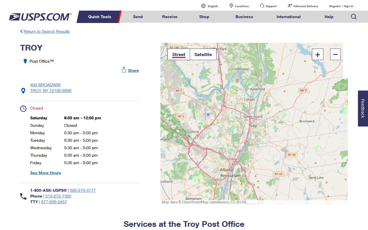
The USPS Troy Post Office location page is the source for the assigned postal capture. It identifies the Troy Post Office at 400 Broadway and provides facility context, not a municipal boundary.
For an address-level result, use the USPS address-to-ZIP lookup. Its Street Address, City, and State fields yield a delivery result for the entered address, subject to the form’s current validation and disclaimer.
Check a Troy ZIP Against Parcels
A ZIP code narrows a mailing question. It does not identify the assessor, recorder, or city service authority on its own. Once USPS returns an exact result, test the address in City PROS and then in county PROS if the city result is missing or the postal label seems inconsistent. Save the returned situs address and SBL. Open the parcel in GIS and turn on City Limits or ETJ where the layer is available. That sequence checks whether the postal address and the parcel’s administrative context point to the same place.
- Run the exact street address through USPS and preserve its ZIP or ZIP+4 result.
- Search City of Troy PROS by address. If needed, try SBL or owner name separately, because the portal advises that one criterion can work better.
- Use county PROS when a Troy mailing label may refer to a parcel outside the city roll.
- Open the Troy GIS map for parcel geometry, city limits, and map context.
- Keep the postal ZIP, municipal label, SWIS, SBL, and source date as separate facts.
After the parcel is identified, use the Troy street directory for the fuller address, deed, tax-map, and historical-directory route. ZIP is a useful filter, not a substitute for that street-level chain.
Note: Preserve the USPS result and parcel date together, since a delivery label does not settle municipal jurisdiction.
Separate Troy Postal Geography
USPS assigns delivery ZIPs and post-office labels. The City of Troy assigns municipal services, local code authority, and tax-assessment jurisdiction. Rensselaer County assigns county records and election administration. Courts, state health records, and professional licensing systems can use still other jurisdiction rules. One address can therefore return several valid place labels without a conflict. Each label answers a different question.
- ZIP code
- A USPS delivery-geography label used to route mail, not a city-limit map.
- ZIP+4
- An added delivery detail returned with some exact mailing addresses. Keep it with the USPS result.
- PO Box ZIP
- A code used for post-office box addressing. It should not be assumed to represent standard street delivery.
- Carrier route
- A mail-delivery grouping used by USPS. It does not establish municipal or parcel jurisdiction.
- Postal versus municipal geography
- Two separate systems: one supports delivery, while the other determines city and county records authority.
Read 12182 With Lansingburgh
ZIP 12182 is a useful historical clue, not an all-purpose boundary answer. USPS facility material lists Lansingburgh at 2 116th Street, Troy. Historic Lansingburgh began as an independent village laid out with a rectangular grid and central green in 1770, expanded by 1788, and was annexed to Troy in 1900. An old directory, newspaper, or deed can therefore use Lansingburgh while a current municipal source uses Troy.
Search both names when an address trail crosses that historical change. The 2024 city technical study and the Central Lansingburgh Historic District material provide the local context. For the current record custodian, return to the SBL, SWIS, city-limit layer, and source date rather than relying on the postal facility name.
Handle 12183 and Green Island
ZIP 12183 is the strongest local warning against treating a postal label as a legal boundary. USPS facility material names Green Island at 137 George Street, Troy, while Green Island is an Albany County municipality in the postal-area context. A Troy address on a facility page does not make the relevant parcel a Troy city parcel or a Rensselaer County record.
When 12183 appears, begin with the exact USPS result and then inspect the county and city parcel evidence. If the parcel lies outside the Troy roll, use the appropriate municipal and county custodian. This prevents a postal finding from sending a request to the wrong tax, deed, court, or election office.
Keep 12181 as a USPS Check
The reviewed USPS delivery-label material groups 12181 in a Troy labeling context. It did not establish a current standard street-delivery role from the official sources inspected. That is why 12181 belongs in a source-cautioned ZIP code directory table, not in a confident list of streets or neighborhoods. Run the current USPS form for the exact address and preserve what it returns.
A PO Box or label grouping can be useful operationally while still telling little about the parcel’s city, county, or historic street relationship. Parcel and GIS evidence remain the route for those separate questions.
Use ZIP Carefully in Troy Voter Search
The New York voter lookup includes ZIP, but its function is limited. A registered voter enters county, last name, first name, date of birth, and ZIP to check that person’s own registration, poll site, or mail-ballot status. It is not a ZIP-wide resident listing. A non-match also does not prove that a person is not registered, because the record may be confidential, changed, pending, or entered differently.
Questions about a county election record belong with the Rensselaer County Board of Elections. Voter-file requests have an Election Law §3-103(5) elections-purpose requirement, and qualifying confidential records are maintained separately. The Flateau database makes aggregate non-personally-identifying election data more visible, but it does not turn individual voter data into a general postal directory.
Do Not Put ZIPs in Old Troy Records
Troy’s early directories, deeds, and maps predate ZIP codes. Preserve the original street wording, ward, village name, and map reference from an 1829 or later directory entry. A modern ZIP can be added as a separate current geographic aid, but it should not be presented as an original field in a nineteenth-century record. The 1915 House Directory is the local address-first resource for later historic work, while pre-1915 work begins with annual name directories and street guides.
For period context, directories, Sanborn sheets, and tax maps are more useful than back-projecting a current postal code. Compare the period street number and map block with the deed’s legal description before joining a historic listing to a present parcel.
Note: Keep a modern ZIP in a separate field when recording a historic Troy directory or deed reference.
Limit Troy ZIP Directory Claims
A ZIP code directory can document the current postal result and the local cautions around it. It cannot establish that a person lives at an address, identify every address within a postal area, or settle a title question. A parcel owner, a deed party, and a historic directory name are distinct roles. Use a records source only for the role and date it actually records.
For family history, property curiosity, or an estate trail, keep a short log of the USPS result, SBL, map layer, and document date. That record of the route is more reliable than a broad claim about a ZIP boundary. Do not use postal or address information to stalk, harass, intimidate, or harm anyone.